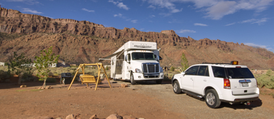
Utah Rocks! Really, this is about Utah’s Rocks and there are damned big!
Note! You can click the images to see stand alone views. You can also click here to go to our gallery to see high resolution images
We have wanted to travel to Moab Utah many times to visit the numerous national parks in the area. Literally, there are more national parks in Utah than the rest the southwestern states combined. As we have traveled across country, we have passed the Interstate 70 sign “Moab – 35 miles south” numerous times, but we have always been on the run. This time was different and we turned right for Moab to see Arches National Park and parts of Canyon Land National Park.
We are on our way to Santa Fe for business and decided to take the back roads from Reno to head through Moab to see Arches and Canyon land, then to Mesa Verde National Park (Cortez Colorado) and into Santa Fe.
We left Reno and headed east toward Salt Lake stopping in Wendover Nevada for the night before trekking through the Salt Lake area the next morning. Wendover is the last outpost of gambling before entering Utah. It is also noted for being the gateway to the Bonneville International Speedway where people attempt to beat the lad speed records in various types of vehicles that range from nearly street cars to rocket powered vehicles that have broken the sound barrier on earth.
We skirted around Salt lake and picked up Utah 6 through the mountains and over to Interstate 70. Great scenery, but it paled to what we were about to experience.
As we saw the Moab turn here sign, the terrain began to change dramatically. If any of you caught the live Grizzly Can shot as we dropped down into Moab, you would have been overwhelmed. It was like driving down into the Grand Canyon, but instead of the Colorado River, we were on Utah 191 headed south.
 We went through the town and headed south to our campground where the coach was backed by 1500 foot high sheer walls.
The next morning we headed to Arches National Park. As we entered the park, we had to show our annual passes and then we were headed up a winding road to a mesa that was about 1,000 feet above us. As we crested the top, everything looked a little like we were on a flat mesa until we came onto the first rock formation.
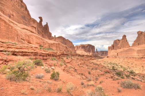
It is called Park Avenue canyon and sort of resembles the sky scraper in Manhattan New York. These are some HDR images from inside the canyon.
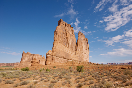
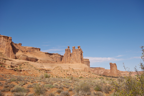
Just after that, literally two turns and a small stretch was a series of high mesa’s and rock spires called Court House, The Gossips and a series of smaller buttes and mesa’s. These images in no way give you a sense of the massiveness of these rock structures. These literally are as tall as the statue of Liberty in New York Harbor and there are over 600 of these features in the park alone.
We scheduled two days to be here and quickly realized that it would take two weeks to see everything that we wanted to. As we always say, we never try to see everything at once when we stop somewhere so that we have an excuse to go back. In this case, it is not an excuse, but a necessity to return.
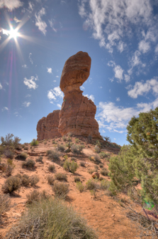 The next stop is a place called Balance Rock and is obviously named. This is a series of HDR images where we try to capture the enormous height and precarious balance of the big rock on top. Try as we might, this again gives no sense of how massive these rock formations are. Ironically, all over the park, people have created miniature rock structures stacking different shape and size rocks to somehow simulate what they are seeing in a small scale.
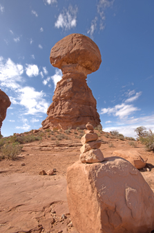 This images tries to give the perspective to the camera, but fails miserably. Like everywhere we go, we are merely trying to chronicle what we see in hopes that it will inspire for our friends to follow behind us and visit for themselves. After all, this is much of the purpose of our SeeLevel adventures.
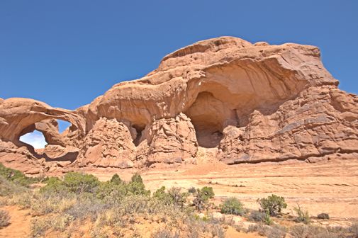
Just down the road is a parking area to a number of arches. When we pulled into the parking area, it was full, so we had to go down to an overflow area. When we got the cameras and equipment out of the car, we noticed most people headed up a flight of stair to one of the more famous arches. We also noticed that some people were going the opposite way and headed for what looked like a big rock structure with no particular features. We looked at the park map and it said, Double Arch, so we decided to head that way. Grabbing our always important water bottles, we started the trek toward this monolith.
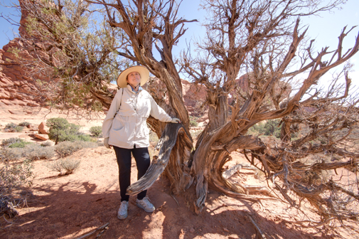
When we got about half way, we stopped under a desert tree for some water and snapped this picture of Wendy to show the power of our new found HDR technology. Here the handheld 7 exposure HDR captures all ranges of exposure in this moon-like contrasty environment.
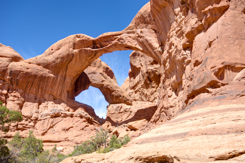
We kept going and began to see this huge hole being bored into the rock face by millions of years of wind. As we wound closer, we noticed a single arch to the side of this giant rock. As we got closer and closer, we noticed that there was a second arch attached at a single rock point with the other arch. Then we noticed that there was actually a third aerial arch created by the two vertical arches. HDR photography permitted us to get this image without the deep dark contrasty shadowed areas normally seen in photographs of these arches. We were struck by the enormity and if you look very carefully, you might find people climbing it, but we doubt it. They are just too big.
What quickly also struck us was that how few people made the trek to these beautiful structure. We surmised that it is probably because you cannot see these structures from the parking lot. You have to venture out to see them. We sort of smiled at each other and said, how is that like life. People just seem to want to experience everything from the parking lot!
So after about an hour at the Double Arch, we headed the other way to see what everyone else was going to see. We trekked back to the parking lot, grabbed some more water and headed up the stair from the additional parking area to the main parking area and then up to a series of other arches.
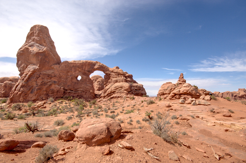
Twin arch and another arch called Turret overlooked a huge expansive upper plain. They were beautiful and amazing structures of nature, but it somehow paled to Double Arch. Maybe because we felt like Double Arch was a discovery for us.
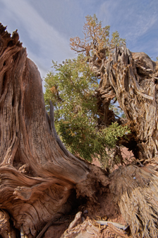 Along the way, we saw this toppled tree with huge striations in the trunk and yet it was still alive with greenery pulling from one side. We thought of how strong it’s will to live must be. So we honored it by trying to capture this image of how torn and stripped it is with still the spark of like and will to survive. We thought of the old song by John Cougar Mellencamp with the lyrics, “life goes on long after the thrill of living has gone.” This tree represents many in this high desert. Even though it has seen many things and lays broken, it still flourishes. We wonder how many people just passed without saying hello.
It was getting late and the thunder storms were firing up. As we stood near Turret Arch, the southern sky became jet black and we could see lightening in the distance. Now about 15 minutes walk from the car, when we heard the first clap of thunder, we were out of there. We got back to the car and started out of the park to head back to the Grizzly and dinner. It began to rain which seemed like a fitting end to a marvelous day.
We stopped at Park Avenue in hopes of getting some interesting pictures with the changing sky. This panorama wa the first we could create that gave even the slightest scale of this enormous park. These Russian tourist arrive en mass in a Setra bus from Chicago…yes Chicago! They flooded the Canyon like thousand of ants, well at least 100. And yes, they were a welcome sight because they served us by putting this place into perspective.
As we drove from the park, we were tired and overwhelmed at the beauty of this place. We said we must return as we talked about our next day at Canyon Land National Park. Four roads into it and we can only choose one because it was so large.
Canyon Lands National Park and Utah’s Dead Horse State Park.
We got up in the morning and had a series of phone calls that had to be tended to for work. After calls and emails, it was now 11 am and we decided to go to the closest entrance to Canyon Lands. Just north of the Arches National Park entrance is Utah road 313 whose entire purpose is to take people to Islands in the Sky and Dead Horse Point. You know this area because of the movies that were shot here including Mission Impossible II’s opening scene with Tom Cruise handing by his finger free climbing the monolith and for Thelma and Louise’s famous driving off the mesa scene. Many more movies have been shot here and we encourage you to Google the many movies shot in the Moab area.
Driving up the mesa, our first stop was to be Utah’s Dead Horse State Park. Well, it was about thirty miles and we decided to stop at one of the campgrounds that dot the 313 to dead Horse. We stopped at one called Cowboy Campground in hopes that we could find a place where someday we could bring the Grizzly and camp over night under the unlit stars. We stopped and met the Campground Host. Named Mickey…maybe his real name…he was friendly and crusty, but certainly lacked companionship because he talked our ears off telling us about all the campgrounds that he had worked in and why he would not return to some like Zion. He was a sort of Edward Abbey character who is famous for the book he wrote about being a park ranger in Arches one season. Titled Desert Solitaire, Abbey went on the write a number of screen plays that were filmed in the area. It was getting late, so we decided to press on to Dead Horse and schedule another trip to see all of Canyon Lands.
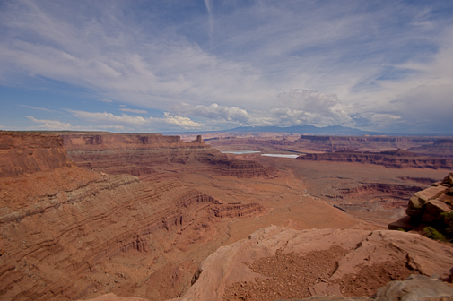
We arrived at dead Horse State Park to an empty ranger kiosk designed to collect $10 per car as an entrance fee. We grabbed an envelope, put our 10 in it and shoved it through the slot in the door. As we drove up to the visitor center, there was no sense of what we were about to experience. Continuing, we came to the end of the road, parked and walked to the edge of this shear drop. What we saw next was beyond any experience we had even at the Grand Canyon walking to the edge for the first time.
This is the image of what we first saw.
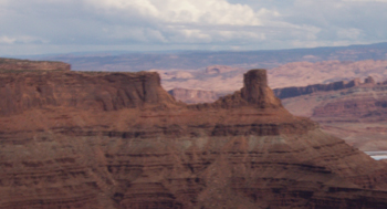 If you look into the distance, you will see that single mesa that was where Tom Cruise hung from his finger tips…well, at least the stuntman did. Amazing! No other words can describe it, so it is a must see before you die place…No Shit! It really is!
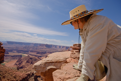
We turned around 180 degrees and caught this scene looking west. Here Wendy is gazing at this huge canyon. Again, no perspective can be communicated with words.
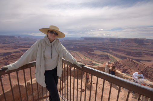
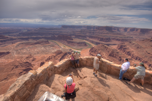
We trekked toward what was obviously a point or end of land. The view was 270 degrees and everywhere we looked the images were different. From salt ponds to a flowing river below, it was spectacular. These final images again call on Wendy and our friendly tourists to try to put this place in perspective.
Did we say this is a must see place!!! Until next time. We are definitely returning and soon!



Fantastic !!!! And Bob posted them on the site for all to view…
in ” jig ” time !!! Or, did he really get help from Diz ??? Or,
‘Bella, maybe ??? In any, and all cases, the Griz crew came through
again to share their wonderful trip with all. More Later, as we
absorb and re-review each and all. Meantime, Cortez and the Mesa
world !!!! Fair winds and Blue Sky wishes…